Country: Korea,
 Visit website
The Hantangang UNESCO Global Geopark (Republic of Korea) is one new member of the GEOfood movement across UNESCO Global Geoparks!
It is located in the central part of the Korean Peninsula. It follows the Hantangang River and covers ca. 1,165.61 km2 . Two provinces (Gangwon-do and Gyeonggi-do) with three local governments (Cheorwon-gun, Pocheon-si, and Yeoncheon-gun are involved.
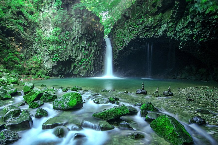
Hantan-River Geopark is the first geopark in Korea to be formed with a river as its’ center. It includes Hantan-river, which rises from Pyonggang-gun of North Korea, and also the overlap area of the Imjin-river, located in the lower course of Hantan-river.
The Hantan-river was formed about 500,000~130,000 years ago by a Volcanic explosion. Lava overflows made flat topography near the rejuvenated Hantangang River. As a result, the area is also blessed with ecological, cultural, and archaeological aspects. The lava which flowed from the explosion created various geographies such as Basalt cliffs, columnar joints and waterfalls, and eventually developed the beautiful landscape!