Photo: …
GEOfood EDU

GEOfood parners running several educational projects linked with local communities and sustainability issues, like climate change, geo hazards and geological resources. UNESCO Global Geoparks main goal is linked with education of new generations towards future challenges.
GEOfoodEDU
The GEOfoodEDU is a two years project, financed by NORA (Nordic Atlantic Cooperation), which is an intergovernmental organisation under the regional cooperation programme of the Nordic Council of Ministers and it brings together Greenland, Iceland, Faroe Islands and Coastal Norway.
The project, led by Magma Geopark, will sustain the areas involved in developing innovative strategies focused on sustainable development, good practices related with food consumption through the development of tailored educational materials.
GEOfoodEDU will disseminate good environmental practices related with use of local food also thanks to the GEOfood brand, owned by Magma UGG and in use in 16 UNESCO Global Geoparks in 9 Countries. GEOfoodEDU aims to expand the use of the brand into the NORA Region, involving local food producers, restaurants, incentivising the use of km-zero food chain and use of traditional regional food. The GEOfoodEDU partners will explore possibility for GEOfood trails and routes tailored for slow tourism based on local heritage, implementing with innovative contents the TeachOut APP for outdoor education.
The project Partners are:
- Magma UNESCO Global Geopark (Magma) – Norway (leader)
- Katla UNESCO Global Geopark (Katla) – Iceland
- Geological Survey of Faroes (Faroes)- Faroes Islands
- Innovation South Greenland- Greenland
Project outcomes:
- Educational teaching materials related to sustainable development practices within food production (GEOfood MANIFESTO), biodiversity, geodiversity, waste food reduction, soil protection.
- Storytelling based on local heritage for the potential GEOfood products and restaurants. Each producer and restaurant will get specific description which explaining to the consumers the peculiarity of the local geological heritage and the related food products.
- Map and booklet with collected recipes, legend and intangible heritage stories from local communities in connection with local food products.
- Videos about Geopark´s locations and sustainability issues linked with local food and heritage
- Short report for implementation of GEOfood brand in aspiring Geopark – with specific focus on Faroes
- Dissemination of the GEOfood brand in the NORA Region.
GEOfoodEDU Booklet

Innovation South Greenland - Igapall Food Tour in South Greenland in October 2021
This movie proudly showcases the Igapall Food Tour in South Greenland in October 2021, the latest gastronomic initiative from Igapall founders Salik Parbst Frederiksen and Miki Siegstad. Igapall Food Tour is a pure celebration of Greenlandic chefs and the beautiful melting pot of Greenlandic ingredients that is South Greenland. Over the course of two weeks, these connoisseurs travelled to three towns in South Greenland sourcing food from local fishermen, farmers and hunters, collaborating with students at Greenland’s one and only culinary school, Inuili, and finally opening a pop-up restaurant in each town with gorgeous 3-course and 5-course tasting menus. Igapall Food Tour is an inspiration and invitation to all to join in the Greenlandic food revolution.

Fossmoen Frukt & Cider - Magma UNESCO Global Geopark
The climate in Dalane is well suited for growing fruit. Our idyllic orchard is faced southwest, which gives the fruit an abundance of sun and light. The garden is protected by mountains in the north-east and thus sheltered from cold winds that can be harmful to trees and fruit.
Favourable climate gives the trees good growing conditions to bear fine fruit. Fruit is the main ingredient in the production of Cider, and high-quality fruit is crucial for high-quality cider. Our fruit production is done almost organically, with an emphasis on the use of organic fertilizers and as little pesticides as possible to protect nature and insect flora.
Fossmoen is a Magma Geopark´s GEOfood member thanks to its commitment to work within sustaianble practices.

Den Brune Bie - Magma UNESCO Global Geopark
The Nordic black bee is considered to be an ecotype or subspecies of the old European bee. The Nordic black bee is the only original bee race in Northern Europe, and is nowadays listed as endangered. In the pure breeding areas in Flekkefjord, Lund, Sokndal and Sirdal, it is forbidden to keep other bees than the black bee. Here are the the natural borders such as mountains and seas that isolate the stock and prevent mating from other bee breeds.
Thanks to the few beekeepers who choose to participate in the breeding work for the black bee, Norway has today the largest remaining stock of the black bee. The work done for this bee rase is essential for the breed to still have a future in the beekeeping.
Sverre Sirevåg was born in 1927. He began to raise bees at the age of 14. By that time he had two beehives of his own and he also raised bees for others. By 2010, his daughter Gretha took over the business with her husband Geir-Arne and with the help from their mentor Sverre.
Den Burne Bie is a Magma Geopark´s GEOfood member thanks to its commitment to work with bees in a sustainable way, respecting the environment and biodiversity.

Flekkefjord School- Sea Weed - Magma UNESCO Global Geopark
Discover with us the power of the sea weed which growing in the bottom of the North Sea along the coast of Magma Geopark. Students from Flekkefjord Videregående Skole (upper secondary school) are explaining us the benefits of eating sea weed and why is important respecting the environment and the sea and take care of this important resource.

Storeknuten - Magma UNESCO Global Geopark
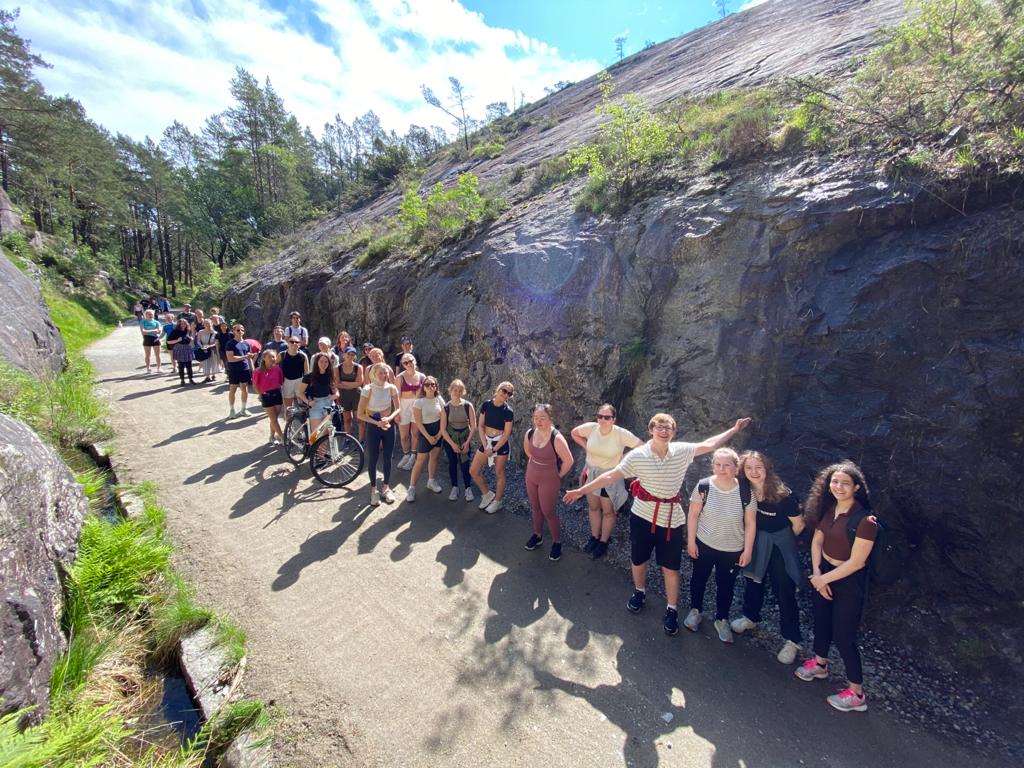
Almost a billion years ago, the area of Magma Geopark was about 20 kilometers below the surface of the Earth. Hot magma at depth started to solidify and separate into a variety of rock types, some of which are layered. Storeknuten is a locality where you can see some of this layering in the largest layered intrusion in Western Europe.
The path to Storeknuten passes well-developed layering in rocks belonging to the Bjerkreim-Sokndal layered intrusion. Each of the layers represents the crystallization front which was located on the floor of the magma chamber 926 million years ago. While it was solidifying, pieces of the roof of the magma chamber fell off and sank to the floor where they became engulfed by the advancing crystallization front. These blocks of rock that have been “buried” in other rocks are called inclusions.

Crowberry jelly from Eldgjárhraun lava field - Katla UNESCO Global Geopark
Æsa Guðrúnardóttir is born and raised in the small village of Vik and now lives on the old farm of Norður-Vík in Vik. She has been going to berry picking since she was a little girl and usually went with her mother, grandmother, and other family members. She has kept that tradition and chooses to go berry picking when the weather is nice and enjoys being out in the nature. Going berry picking is still a family event, as most of the time her boyfriend Haukur and her four daughters go with her. The best place to pick berries are in the lava field of Eldgjárhraun, about 60 km east of Vik. Eldgjárhraun lava field was formed in a large fissure eruption from Eldgjá, which is a part of the Katla volcanic system, around the year 939 and is the largest lava field to have formed on Earth in the last 1200 years. Another equally impressive lava field, called Eldhraun, is close by and was created during the 1783-1784 eruption of Lakagígar. They can be told apart as the younger lava field is still rough and covered by moss while over the centuries, wind, and water erosion, aeolian sediments, ash from volcanic eruptions and sediments brought in by glacial rivers have filled in the Eldgjárhraun lava field and levelled it, allowing more complex vegetation than moss to colonize the lava field, with one of these plants being the crowberry.

Fulmar - Katla UNESCO Global Geopark
Hunting fulmars is a long and well-established tradition in Mýrdalur, south Iceland, and despite that the fulmar does not play as an important role in the diet as it once did, it is still an important link in the culture of the area. Much fewer fulmars are hunted today but they are prepared and cooked the same way as they used to be. Here, Áslaug Einarsdóttir tells us how she prepares and cooks fulmars and what she serves with the fulmar, including soðkökur bread.

Fish Farming in lava field - Katla UNESCO Global Geopark
In Signabøur on Streymoy some special stories can be experienced in the coastal landscape. A lot of shells lie on the ground next to a large flat rock close to the shore. Here you find broken shells from various kinds of whelk and mussel, and you wonder how these broken shells ended up by the flat coastal rock. If you were here a busy day in the summer, you could observe what is going on by the shell rock. Oystercatchers and other birds living from shellfish collect fresh shells close to the shore. They fly up in the air with the shells, and high above they drop the shell so that it hits the shell rock. As the shell falls to the ground and lands with force on the flat rock, the shell shatters, and pieces of broken shells scatter around the flat rock. The story behind the shell rock is a story about how the animal world makes practical use of the available surroundings, – in this case the flat coastal rocky ground.

Lindarfiskur- Katla UNESCO Global Geopark
Lindarfiskur is a family run fish farm that was founded in 2011. The grow arctic char at a place called Botnar, deep within the lava field of Eldgjárhraun and almost surrounded by another lava field called Eldhraun. There they grow about 100 tons of char and the farm has a policy of being as sustainable and environmentally friendly as it can be and there is no waist from the farm. For the farm they use fresh water from the glacial river of Skaftá that has flown through the lava fields and has been filtered by the process.

Growing Rapeseeds in the shadow of Eyjafjallajökull Volcano - Katla UNESCO Global Geopark
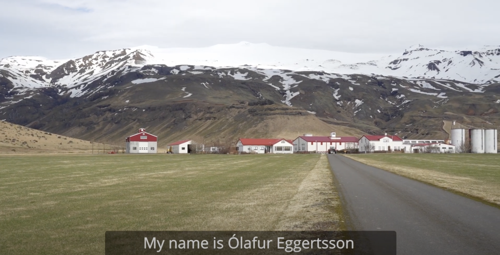
Ólafur Eggertsson and Guðný A. Valberg live on the farm Þorvaldseyri and Ólafur is the third generation of his family that lives there since his grandfather bought the farm in 1906. Ólafur and Guðný have four children and their son, Páll Eggert Ólafsson, will take over the farm in the future. Þorvaldseyri farm is located south of a volcanic mountain chain called Eyjafjöll and is semi-surrounded by four mountains, the Steinafjall mountain to the west, Lambafell and Raufarfell mountains to the east and the infamous volcano Eyjafjallajökull to the north. It is this location that makes the growing conditions for crops so good, as glacial rivers move sediments down to the lowlands during spring flooding and glacial outburst floods and volcanic ash is periodically spread over the area during eruptions of Eyjafjallajökull, Katla Volcano and other nearby volcanic systems. The sediment and the volcanic ash have over time created a nutrient rich soil that is now used for agriculture. The last eruption and the following glacial outburst flood that spread ash over the area was during the 2010 eruption of Eyjafjallajökull Volcano. Large amount of ash settled in the area, and it took farmlands several years to recover completely. The thickness of the ash was about 4-5 cm near Þorvaldseyri farm and any thicker and it could have suffocated the underlying vegetation. The ash did a lot of good as well even though it did harm for a short period of time, as vegetation blossomed once the ash had been integrated into the soil.

Faroese seaweed is food and provides shelter - Faroes UNESCO Global Geopark
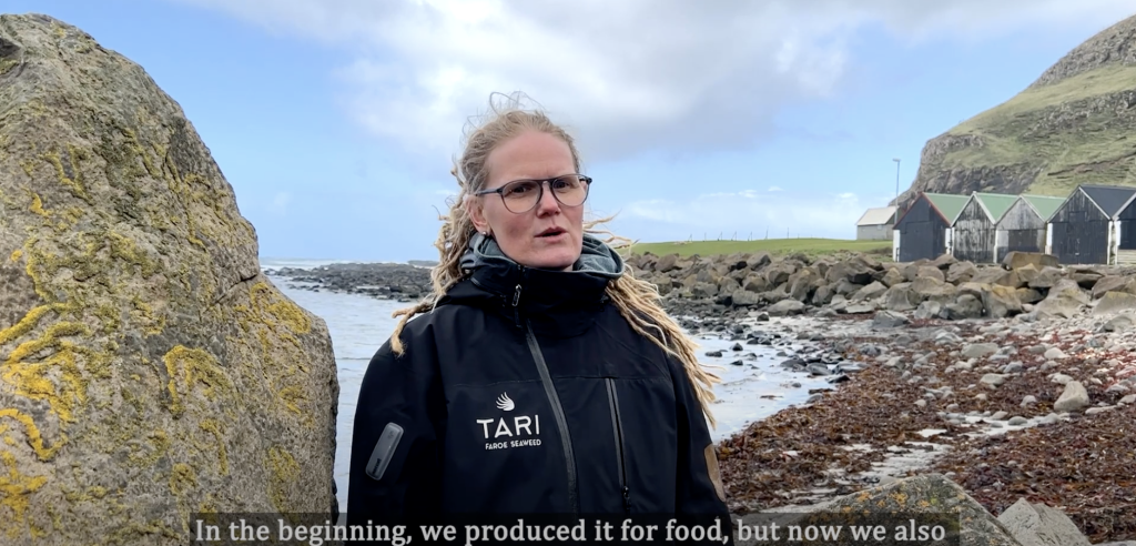
The bay in the little beautiful village Fámjin on the western side of Suðuroy lies protected behind shallow scerries. Inside the scerries is a shallow lagune, while westward is open ocean. In Fámjin the tidalwater and natural environment provides good growing conditions for seaweed. The unique natural environment in Fámjin has caught the attention of Agnes Mols Mortensen. Agnes is a biologist, PhD, and has experience growing and using seaweed for food in the Faroe Islands. She and her brother Mortan Mols Mortensen have established the aquafarming company Tari, and their hatchery activities are located in Fámjin. The company grows seaweed and develops products to sell to markets in the Faroe Islands as well as abroad. Tari has developed various food products, such as Ocean Spaghetti (known as sea thong) which can be used as vegetables, and Ocean Wings, which can be used for spicing and salt. Agnes and Morten are developing a new product, which has caught the interest of large fish farming companies in the Faroe Islands and internationally. Salmon farming is an important industry in the Faroe Islands and one of the challenges that the industry struggles with is sea lice which are bad for the salmon. The little fish lumpsucker is commonly used in the salmon aquaculture as cleaner fish to eat lice off the salmon. However, with no shelter or resting places the lumpsucker thrives poorly in the salmon cages. Tari is developing a shelter made from seaweed, that the small lumpsuckers can use for hiding and resting. The seaweed shelters, named Akvanest, made from natural material, are a sustainable way to improve the living conditions of the sea lice eating Lumpsuckers which will improve the production of salmon for food consumption. The Akvanest is becoming a very interesting product that Tari can produce for the fish farm industry, both in the Faroe Islands as well as internationally.

Stóra Dimun - Faroes UNESCO Global Geopark
The bay in the little beautiful village Fámjin on the western side of Suðuroy lies protected behind shallow scerries. Inside the scerries is a shallow lagune, while westward is open ocean. In Fámjin the tidalwater and natural environment provides good growing conditions for seaweed. The unique natural environment in Fámjin has caught the attention of Agnes Mols Mortensen. Agnes is a biologist, PhD, and has experience growing and using seaweed for food in the Faroe Islands. She and her brother Mortan Mols Mortensen have established the aquafarming company Tari, and their hatchery activities are located in Fámjin. The company grows seaweed and develops products to sell to markets in the Faroe Islands as well as abroad. Tari has developed various food products, such as Ocean Spaghetti (known as sea thong) which can be used as vegetables, and Ocean Wings, which can be used for spicing and salt. Agnes and Morten are developing a new product, which has caught the interest of large fish farming companies in the Faroe Islands and internationally. Salmon farming is an important industry in the Faroe Islands and one of the challenges that the industry struggles with is sea lice which are bad for the salmon. The little fish lumpsucker is commonly used in the salmon aquaculture as cleaner fish to eat lice off the salmon. However, with no shelter or resting places the lumpsucker thrives poorly in the salmon cages. Tari is developing a shelter made from seaweed, that the small lumpsuckers can use for hiding and resting. The seaweed shelters, named Akvanest, made from natural material, are a sustainable way to improve the living conditions of the sea lice eating Lumpsuckers which will improve the production of salmon for food consumption. The Akvanest is becoming a very interesting product that Tari can produce for the fish farm industry, both in the Faroe Islands as well as internationally.

Raising sheep in the shadow mountain meadows - Faroes UNESCO Global Geopark
The village Signabøur is located on the southern slope by the fjord Kollafjørður on the island of Streymoy. The steep north-facing mountain slopes mean that being in the village you would not see the sun in the middle of the winter and the whole mountain slope receives no direct sun light in the middle of the winter. The lack of direct sunlight gives some special challenges and opportunities to the farmer, Dorthea Joensen, who runs the farm Signabøgarður with her husband and family. They have run the farm as a family business for many generations and have learned how to raise sheep in the shadow mountain meadows. The Signabøgarður-farm is about 5,4 km2 reaching from sea level to the mountain of Kaldbakskambur 588 meters above the sea. The farm has a value of 6 merkur according to the ancient land value system which is still in use. In the spring, the north-facing mountain slope, which is in total shadow during the middle of the winter, suffers from slow and late spring growth. The farmers need to feed the sheep more and for a longer time than most other farmers. The land of the farm is steep in many places and sometimes so difficult to reach that it can only be reached by boat. To productively use all the land, the farmers put special effort into selecting sheep that in a natural way chose to live in the various places throughout the farm. In the autumn the benefit of the location on the north facing mountain slopes is evident. The grass that was so slow to begin growing the spring now continues growing late into the fall, providing the sheep on the mountain slopes with fresh grass until the time of slaughter. The fresh autumn grass from the north-facing slopes is good for the sheep, and the mutton that will be produced on the farm gets a special and good quality.

