Country: Italy
 Visit website
 Visit social media
The Geopark area is characterized by its geological diversity. The northern area shows triassic and flyscioid deposits with beautiful quartzarenitic formations. While in the southern area prevails the presence of the gypsum-sulphurous plateau created during Messinian crisis between 5,96-5,33 million years ago.
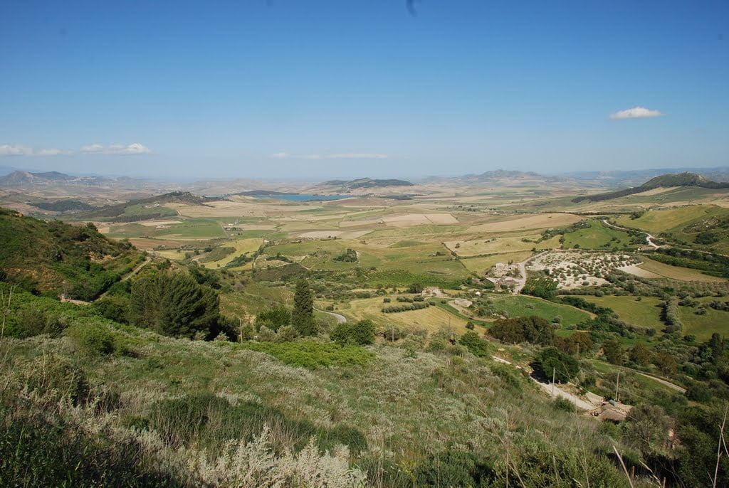
The territory is composed of 17 municipalities located in the real middle of the Island is characterised by an hilly landscape, cultivated with grain monoculture since the Copper Age (app.3200 b.C).
The diffusion of the grain culture has been strictly linked with the pagan cults of Dementra-Cerere which it gives the name to the Geopark as well.
In general, the high presence of quality artisanal products and agri-food products with territorial specificity (PDO, PGI), organic and valuable productions in the dairy, extra virgin olive oil and bread and pasta sectors, the great capacity to production and innovation in the fruit and vegetable sector, are the basic elements of the “Sapori di Demetra” network of typical products of the area.
This area intended as a synthesis of the set of natural and cultural assets; it is deeply linked with the inalienable heritage of the local community, as a value capable of promote a different use of the territory and new forms of sustainable development.
The Rocca di Cerere UNESCO Global Geopark area is located in the central zone of Sicily Region and falls into the central southern belt of the Province of Enna. The Rocca di Cerere UNESCO Global Geopark is located on a gypsum-sulphur plateau with sandstone peaks.
The UNESCO Global Geopark is characterized by its geological diversity. Geologically the area covers central part of Sicilian foredeep between the Appennine chain and the Iblean foreland. In its northern area the thrust belt within the southern branch of the Erei Mountains, was formed by the collision of the African and European tectonic plates. The northern area presents deposits with beautiful sandstone formations. This on-going tectonic impact will ultimately lead to the closure of the Mediterranean Sea. The area is significant for its gypsum and sulphur deposits which were laid down during the Messinian Salinity Crisis between 5.96/5.33 million years ago. Abandoned sulphur mines and the history of sulphur extraction can be seen in the Floristella-Grottacalda Mining Park, one of the most significant sites for industrial archaeology in southern Italy. This crisis occurred due to the desiccation of the Mediterranean Sea when the Straits of Gibraltar closed. The crisis ended with the return of the sea and the deposition of “shallow marine” deposits. Here emerged diffusely the most powerful and extended sequences of evaporitic rocks of Messinian age of the entire mediterranean basin.